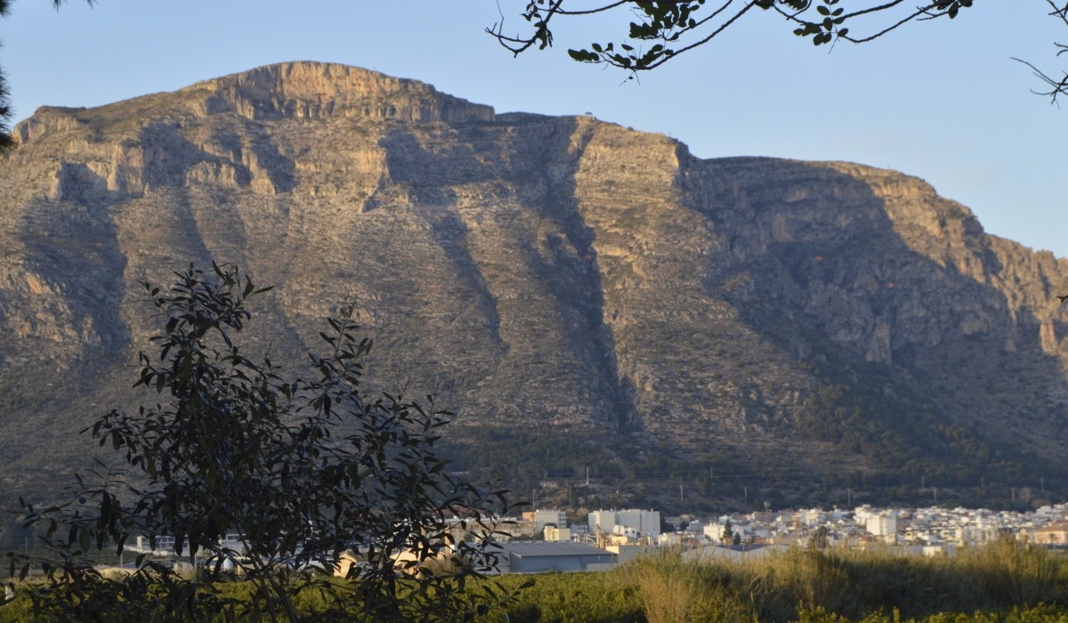
This route runs through the mountain of Las Cruces, starting at the municipal sports centre and continues through the town centre until it reaches the defence wall. At the end of this section, we find the Calvario on our left.
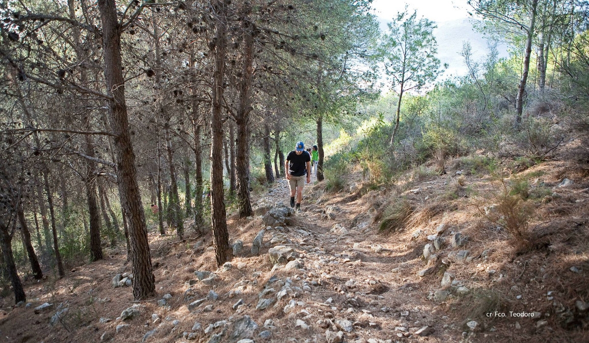
From this point, we head to the right, in an easterly direction, following the defence wall, until we reach a bridge that crosses the aforementioned wall. Cross the bridge and start to ascend along a path through an area of pine trees (PRCV-38). The ascent is long, but the slope becomes gentler as the path zigzags.
At the end of the pine forest we find a sign on the left indicating “poblado íbero” (Iberian settlement), the path runs next to a rock wall, on which there is an ancient Iberian settlement, and where there are still remains of the ruins of the castle of Gebalcobra, from the Arab period.
We continue along the path, now on a gentle slope, until we reach the Fontetes de Cantus. This is a spring that springs from the base of a rock, from which only a small trickle of water flows in the summer months. In the area around the spring is the area known as Abrigos de Mossen Ricard. It is a protected area, with four cavities in which there are cave engravings dating back to 12,000 BC.
From the spring, the path is difficult to follow because of the rocks from a landslide. A little further on, it begins to ascend through the area known as La Escala. Although the ascent is short, it is hard because of the steep slope, but when you reach the top, the landscape you can see makes you forget the steep climb.
From this point you can see the rice fields to the north, the mountain of Cullera, the region of Ribera Baja, the Albufera and the city of Valencia in the background. It is worth taking a short break to enjoy the panoramic view.
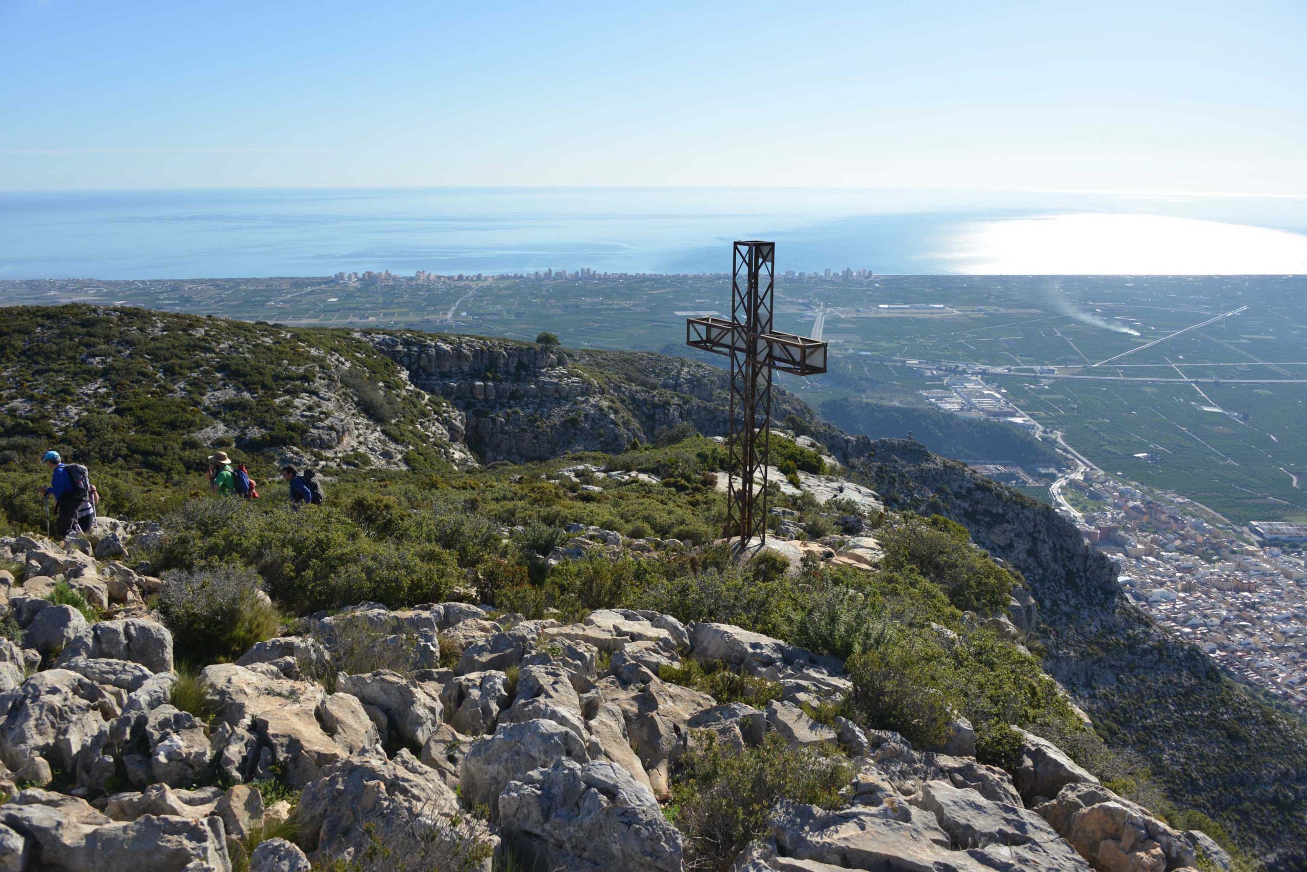
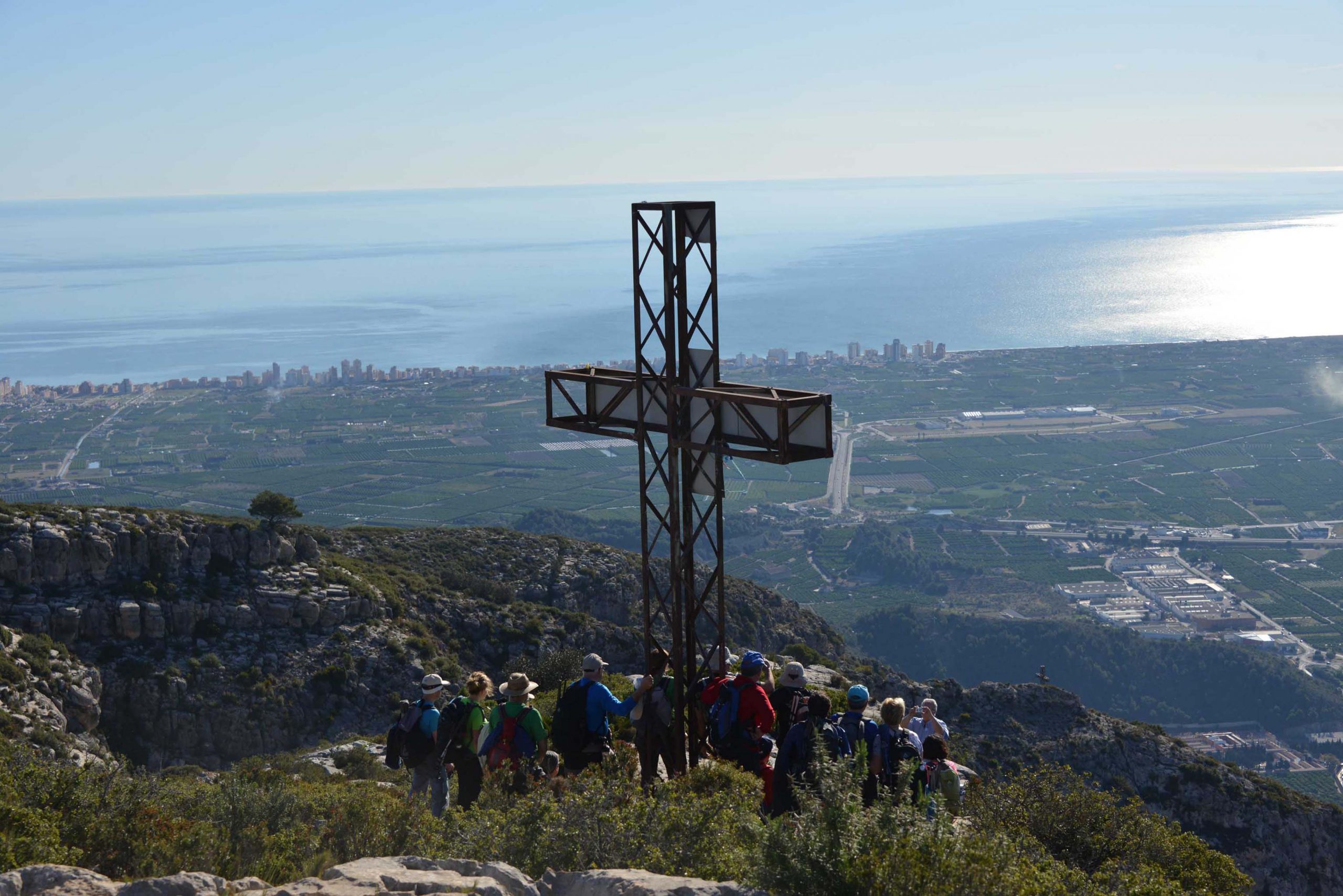
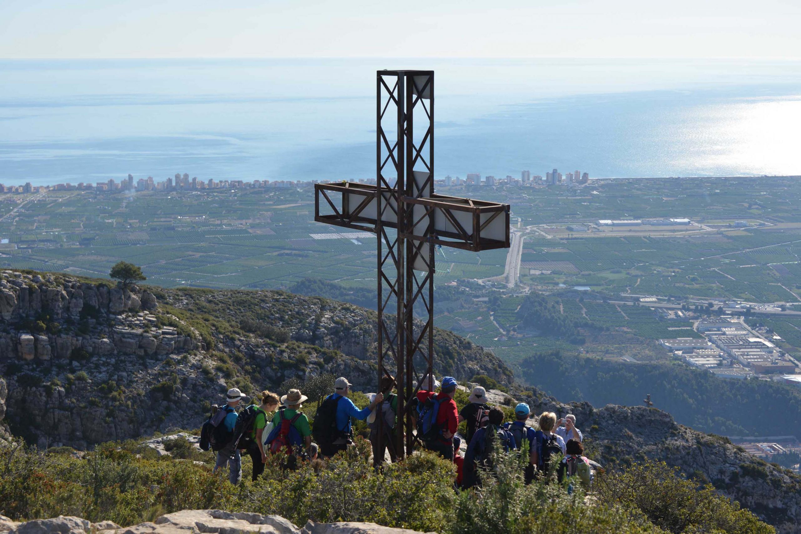
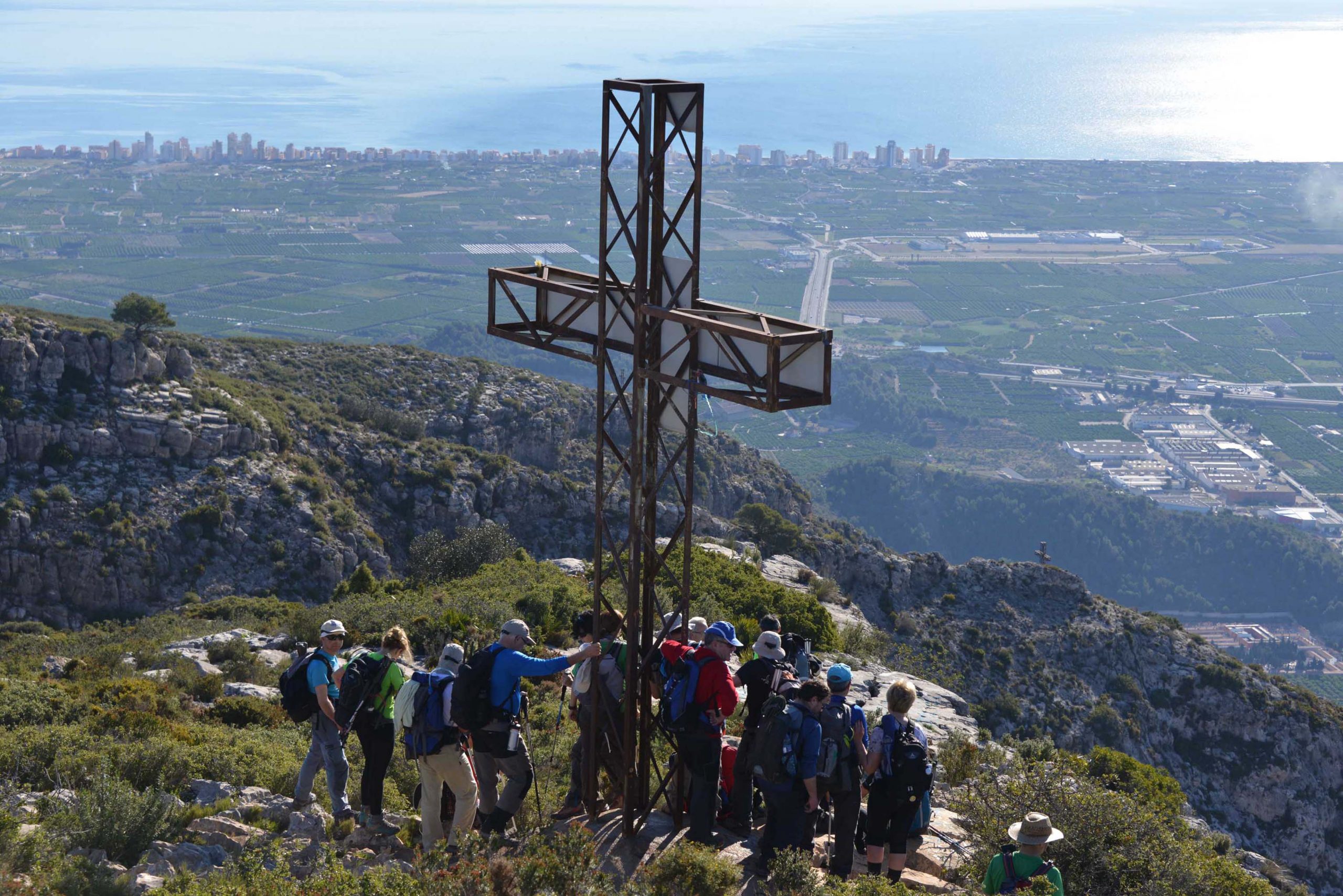
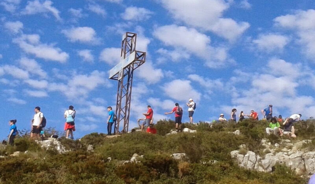
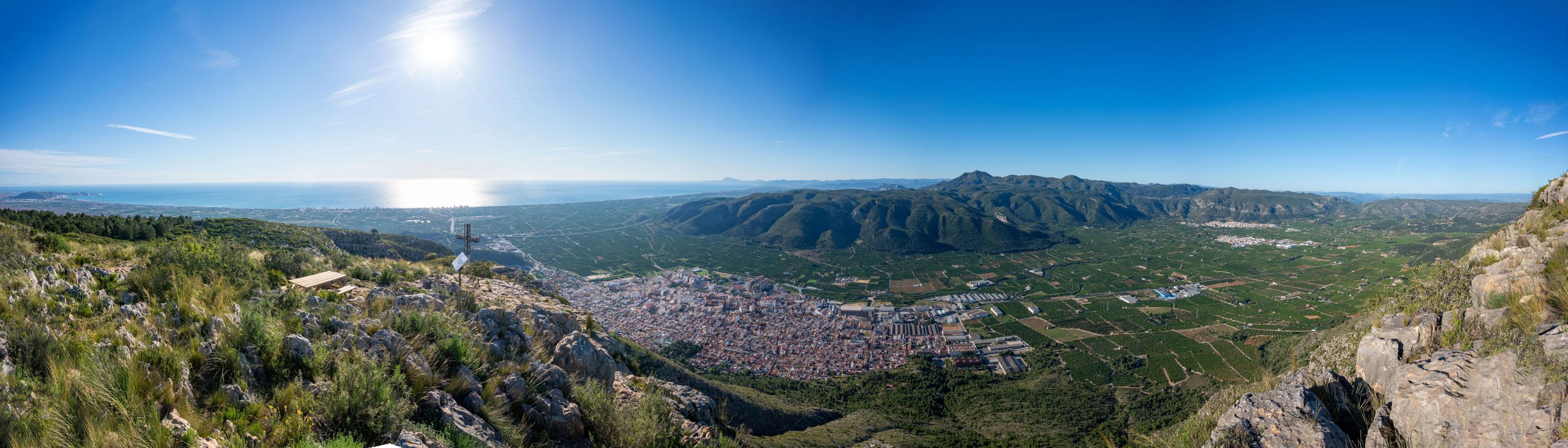
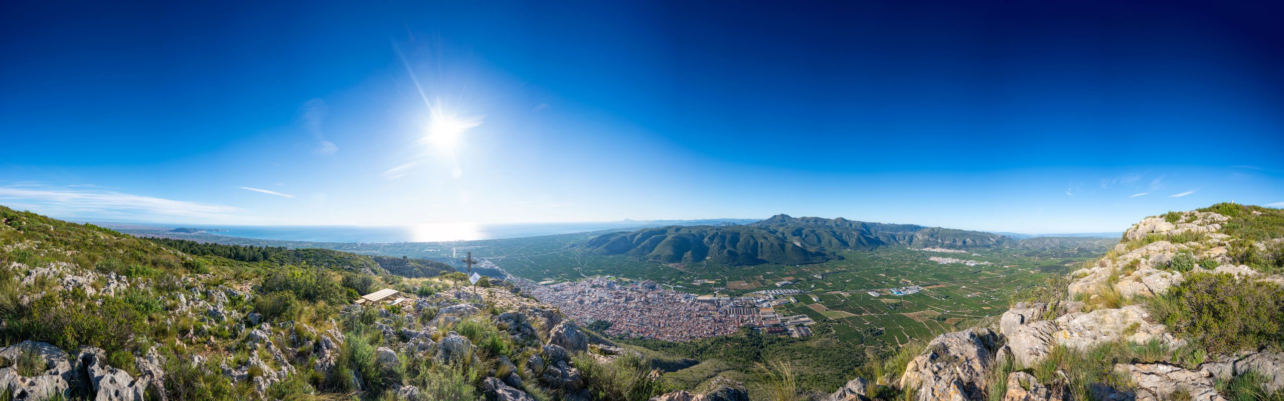
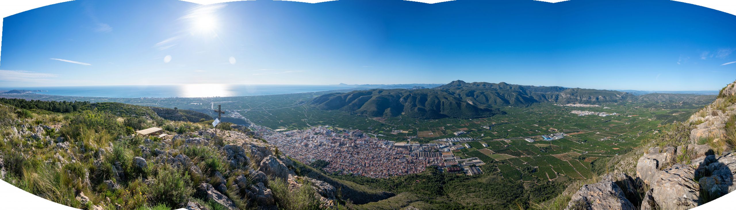
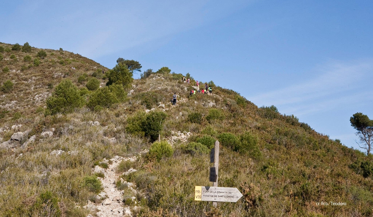
The route now continues in a westerly direction and ascends until it reaches a crossroads where we take the path on the left, which will take us to the cross or viewpoint of Alto de las Cruces (540 metres).
This is the highest point on the route. It is a real balcony from which to contemplate the Valldigna region, from the sea in the east to the Toro mountains in the west. The landscape that we can observe from this place invites us to rest and contemplation.
The path now follows a gently descending section and then the slope becomes steeper until it reaches a crossroads of paths. Take the one to the left, which will take you downhill to a ruined house, passing by an old lime kiln.
At this point there is a crossroads of paths, take the one on the left. About 20 metres further on, there is another crossroads, take the one on the right, which will take you to the Sangonera fountain. The Sangonera fountain is a good place to get water, although this fountain is usually dry in the summer months. In this area there are several picnic tables. A few metres from the fountain there is a crossroads of paths, take the one on the left.
After about 50 metres there is another path junction, take the one on the left, which will take you to the Amoladors area. Start to descend along the historic Amoladors path, which runs along the ravine to the foot of the mountain. This path is made with dry stone walls and a zigzagging itinerary, which was used in the past to access animals such as mules or donkeys, which were used to cultivate the area or as pack animals.
Although route 1 follows the Amoladors path to the foot of the mountain, to the left is the fork of the Camí dels Borregos, or PRV-40, which would also take us to Tavernes, but is more difficult. Also a little further down, on the right, is the access to the via ferrata Les Marujes.
At the end of the Amoladors path, continue along a path heading east until you reach a path that will take you to the defence wall. From there the route continues next to the aforementioned defence wall, up to Jardines street, where, following the same streets that we had accessed the mountain, it will take us to the municipal sports centre or starting point.


